Interpretive Sites
At Souris River Watershed District, we're dedicated to preserving the natural world around us. Our projects are focused on environmental conservation, maintaining habitats for wildlife, and promoting sustainable practices. With our interpretive sites, visitors can explore and learn about the natural wonders of the area.


Bill Poole
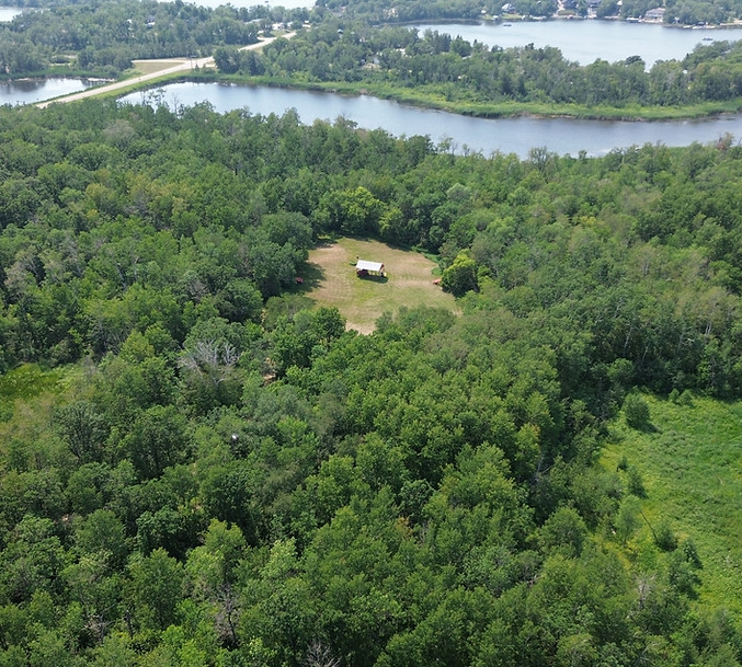
The Bill Poole property is located at SE-06-02-23-WPM and was donated to the SRWD (formerly known as Turtle Mountain Conservation District) by William R. Poole. The property is formally designated as the Bill Poole Heritage Habitat and was donated “For Love of the Land”. The property is a 120 acre parcel of native grassland/hardwood forest and its purpose is to preserve the natural characteristics of the land and to encourage public walking access on the area. The site was named in recognition of the late Bill Poole who was the Manager of the Turtle Mountain Conservation District from 1977-1989.


Metigoshe Natural Area
The Metigoshe Natural Area is located north and east of Arnold Drive on SW-03-01-22-WPM in the R.M. of Winchester. The Metigoshe Natural Area is home to a wide variety of wildlife and native plant species and covers approximately 55 acres. The site is used by the Souris River Watershed District as an educational backdrop for school tours to the area. This area offers students an opportunity to explore different wetlands, plant species, and aquatic invertebrates in a safe, hands-on learning environment. Metigoshe Natural Area is also used by residents of the Lake Metigoshe Community and by tourists as a recreational area. The area includes an observation tower, fire pit, and walking trials that lead to a floating dock and bridge. The walking trails are used for not only hiking but also for cross country skiing in the winter. Signs have recently been placed along the walking trails which give directions and distances to different points for better navigation of the trails.


Newcombe's Hollow Historic Site
See where the buffalo trails passed
Where the Indian trails crossed
Where settlers’ trails left visible ruts
Where N.W.M.P. Cavalcade rested on its trek westward
Where marble tombstones gleam with the sun
Where south-west Manitoba really began
This virgin prairie is now owned by the Souris River Watershed District. A kiosk brings it all to life in a mural painted by Sioux artist Roland Ironman depicting the heritage of this area. A short text explains the rise and decline of the original site of Deloraine.


Whitewater Lake
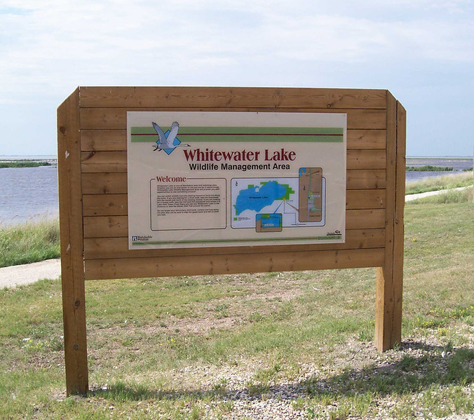
Whitewater Lake is recognized as a Canadian Important Bird Area of global significance. The area provides habitat for over 110 species of birds as well as over 40 species of other wildlife. Once known as “White Lake” due to its white alkali flats. Whitewater Lake is one of Canada’s best known staging areas for waterfowl and shorebirds. The lake is a 9,000ha saline wetland situated in south-western Manitoba between the Towns of Boissevain and Deloraine. Whitewater Lake is within the mixed-grass prairie biome. As a result of the high biodiversity found at Whitewater Lake it has received a number of designations including: Manitoba Wildlife Management Area, Bird Habitat of Canadian Importance for Staging Shorebirds and Geese, and Globally Significant Important Bird Area. Whitewater Lake has also been featured in a number of Manitoba birding books such as “Birder’s Guide to Southwestern Manitoba” and “The Scenic Secrets of Manitoba”.
Location: Northing 5454626 Easting 409756


Sweet Grass Meadow
The Sweet Grass Meadow property is located at SW-25-03-20-WPM, just north of the Town of Boissevain. The property was donated to the SRWD (formerly known as Turtle Mountain Conservation District) by the R.M. of Morton. The property was donated with the intention to preserve the land in its natural state. Additionally, SRWD has agreed to cooperate with local schools in order to deliver educational projects involving students.


Adair Dam
The Adair Dam is a water retention facility and rotational grazing demonstration project located on the eastern half of 22-04-24-WPM in the R.M. of Brenda. Construction of Adair Dam was completed in 1985, and in 1999 the SRWD (formerly Turtle Mountain Conservation District), began a Managed Grazing Demonstration Project at the Adair pasture. The property was initially purchased for the construction of water retention facility for use in flood protection, erosion control, and wildlife habitat. Land use guidelines for the pasture allow a once over-grazing system to commence on June 1st and to end on August 31st and SRWD provides a portable livestock handling system which is available free of charge.


Gerald W. Malaher WMA
The Souris River Watershed District helps to maintain the Malaher
Wildlife Management Area. It is located a few minutes west of Melita on PTH 445 just west of the town of Melita is the Gerald W. Malaher WMA. The WMA is named for Gerald Malaher, Manitoba’s first Director of Wildlife, then called the Game and Fisheries Branch. Malaher worked much of his life in the north and was responsible for innovations such as the registered trapline system and conservation of barren-ground caribou. He was a forester by training, but cared deeply about the northern people and wildlife. He was named director in 1946 after spending 20 years working in the north and wilder areas of the south. Malaher has been compared to other pioneer conservationists such as Ernest Thompson Seton. You can read more about Malaher in his book called “The North I Love”.


Cherry Point Park
Cherry Point is a peninsula on the north shore of Oak Lake named for the chokecherries that can still be found on the wooded shoreline. Today its is a quiet green space alongside a cottage development. A number of interpretive signs have been placed throughout the park and three benches allowing visitors the opportunity to stop and enjoy the scenery. Also two picnic tables and garbage and recycling bins are located on site. There are no washroom facilities.


Canupawakpa Trail
The valley was born some 14,000 years ago as a result of melting glaciers that had formed Lake Regina. Three thousand years of rushing, mile-wide flood waters transformed the landscape to include the winding creek and valley, boulder-strewn hills, outwashes and fertile delta flats.
Vegetation became established providing fruits and berries for wildlife and humans alike. The banks provide habitat for many wildlife species including ruffed grouse, deer, beaver, mink and others.
Homesteaders chose this region because of fertile soils developed after centuries of periodic flooding.
